- Sections :
- Business
- Crime & Public Safety
- Local Area
- More
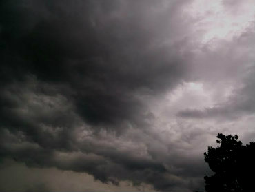
CONROE, Texas - The 83-degree temperature on Christmas day broke the previous record of 82 set in 1969, but winter will correct itself Sunday evening when the temperature will drop by more than forty degrees.
The storm system that moved across Russia the past few days then headed into the Bering Sea west of Alaska, has encountered unusually warm waters, Coupled with bitterly cold temperatures to the north, the dramatic contrast in temperatures has resulted in a significant strengthening of the storm.
The Weather Channel has appropriately named the storm Winter Storm Goliath. As the storm moves into the jet stream, it will travel southeast and arrive in Texas bringing precipitation into the state...ice, sleet, and snow for north and west Texas. As the storm system moves into the southeast Texas area, it will collide with warm weather and showers moving in off the coast, producing severe thunderstorms which will likely to include damaging wind gusts, and the possibility of tornadoes. Rainfall could range from 3 to 6 inches, and possibly more.
Tuesday morning, Conroe will likely see freezing temperatures. Daytime temperatures throughout the week are not expected to rise above the mid-50s; the overnight temperatures will drop into the 30s. Travelers returning from holiday trips should exercise caution, and heed weather warnings.
Protect pets and tender vegetation. Conroe Today will post any weather alerts issued by the National Weather Service, to the Conroe Today social media sites.